North County Trailway
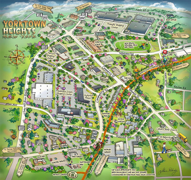
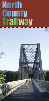 The North County Trailway is a paved pedestrian/bicycle path located primarily on right-of-way lands of the former Putnam Division of the New York Central Railroad. The Trailway covers 22.1 miles from Eastview in the Town of Mount Pleasant north to Baldwin Place in the Town of Somers on the Putnam County border. A map of the North County Trailway below, shows the trail access points and parking areas located in Yorktown.
Location: Approximately 5.5 miles of the North County Trailway are in the Town of Yorktown. The Trailway enters Town along the Route 100 corridor south of Kitchwan, where there is parking access, crosses the New Croton Reservoir and then crosses Route 118 where there is also parking access. The Trailway continues along Route 118 north into the center of Yorktown Heights with two parking areas along Underhill Avenue near Town Hall. Continuing through Railroad Park, the Trailway turns northeast and leaves town at the Trailway crossing with Route 202. A detailed map of the Trailway showing all access and parking areas is available from the Westchester County Department of Parks, Recreation and Conservation at (914) 242-PARK.
To the south, the trailway connects to the South County Trailway, which is another 14.1 miles, south from Eastview to the Bronx border. To the north, the trailway connects to the Putnam Trailway, which consists of 11.85 miles, north from Somers to Brewster. Only the last section from Putnam Ave to North Main Street in Brewster is incomplete.