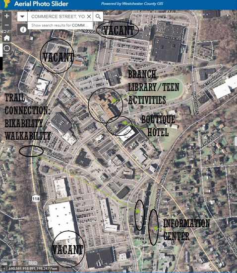
Map of Geographic Area
Overlay District was created for unique Planned Design Districts to strengthen ECONOMIC VIABILITY
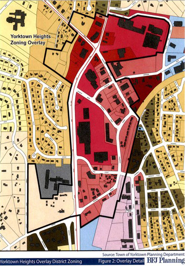
Overlay districts will encourage the redevelopment of dilapidated properties, attract commercial tenants and diversify Yorktown’s housing stock. In a changing world where more people work from home and do their shopping online….STANDING STILL IS NOT AN OPTION